INTRODUCTION
The Sand Point Calibration Baseline is a poignant “working” landmark that is often overlooked and not experienced by park visitors due to its quiet presence in the landscape. Incorporating artistic enhancements with the re-establishment of this subtle yet substantial landmark is a rare chance to illuminate survey work, mapping, and measurement as critically important stages in the process of shaping and navigating the complex world in which we live. Distances can be deceiving. Through a direct interactive experience, visitors will have the opportunity to exercise their powers of perception, learn a bit about the history of survey work and come to understand its importance in obtaining a true measure of distance, locating our position on the planet, and deciding where to go from here.

CONCEPT
Where am I? How did I get here? Where am I going? We all possess a basic human need to explore and, at the least, an idle sense of curiosity about the place where we stand. For children, this curiosity is rooted in that which is directly underfoot, in front if the nose and within arms reach. Adults gravitate towards the sweeping vista, the blue of distance, the great beyond. This artwork satisfies both curiosities through framing a perspective on the landscape in detail and over a great expanse.
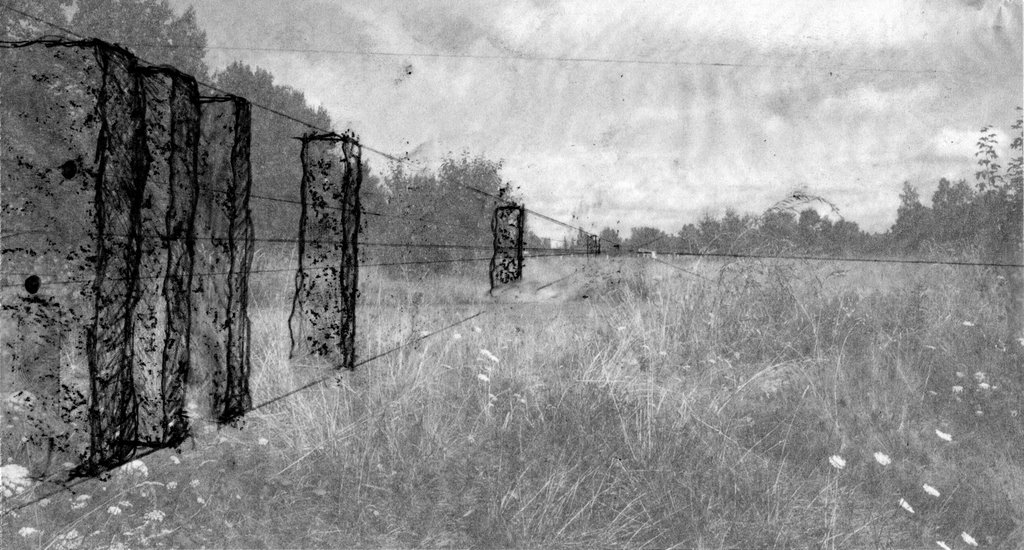
A procession of standing stones will create a sightline leading to the baseline swath cut through the trees in the southeast section of the park. Each stone will be drilled with a unique pattern and sandblasted with educational elements. When viewed individually, each stone serves as an aesthetic point of contemplation. When the observer peers through the stones, the circular drill holes create a framed perspective of the trees, grasses, sky, and surrounding natural elements of the park environment. The observer will have the experience of making a targeted observation in the landscape, adopting the stance of a surveyor calibrating his instruments.
This artwork will educate the public about the history and spirit of the geodetic survey as well as provide an opportunity for visitors to make a “field” observation. The standing stones will possess multiple narratives in a sequential arrangement. Each stone will be sparsely etched with text, simple diagrams, and graphic elements illuminating various aspects of the calibration process, survey equipment, and historical accounts. These elements will be poetic, non-didactic, and easy for visitors of all ages to understand. Some examples may include: An image of surveyors making observations from a Bilby tower with a theodolite, biographic quotes on the life of Ferdinand R. Hassler and other luminaries, or fragments of language used by surveyors to communicate in the field. This installation encourages multiple encounters and repeat visits, as the view through the stones will change based on atmospheric conditions, the presence of sunlight, and topographic shifts as the wetlands are established and native plants are reintroduced to the area.

A procession is the journey of a participant observer. This artwork creates an opportunity for visitors and residents to become aware of their own frame of reference and provides a basis for further interpretation. How we see determines what we see. With heightened sensitivity towards our environments, we all may derive a deeper sense of place.
SITE ANALYSIS & HISTORY
The Park & The Community
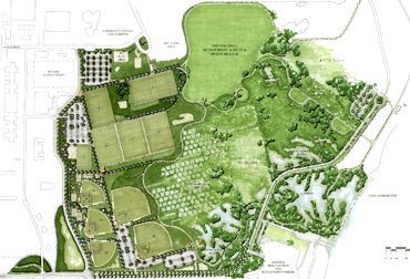
The southeast corner of Magnuson Park features relatively flat topography, close proximity to Lake Washington, open areas with clear sightlines, and easy access to the 000m and 150m monuments for EDM calibration. The nearby Promontory Point features hiking trails, educational community boards, and interpretive trails featuring native plants. In the 1970s, Washington State Senator, Warren G. Magnuson facilitated the acquisition of a de-commissioned naval air station for Seattle park land which became Sand Point Magnuson Park. The park boasts 153 acres of open space, an off-leash area for dogs, an auditorium for cultural events, a community center, artist studios, a sailing center, community garden, sports fields, hiking trails and many other amenities which draw a tremendous diversity of users. Community organizations have been key to the aesthetic development and positive change in the park. The Magnuson Environmental Stewardship Alliance (MESA), The Magnuson Community Garden Organization, Dark Skies Northwest, The Promontory Point Habitat Enhancement Project and other organizations and initiatives contribute greatly to the habitat, aesthetic development, safety, and spirit of the park and its visitors.

CALIBRATION BASELINES & THE NGS
Calibration baselines were first established by the National Geodetic Survey (NGS) to provide a thread of traceability between the national standards for distance measurement and field data collected by instruments in the hands of local surveyors and those who rely on highly accurate distance measurement as part of their daily work. Correctly calibrated EDM equipment, redundancy in measurement, and careful attention on the part of the observer are all critical to obtaining accurate and reliable results. The Sandpoint Calibration Baseline was established in 1981, though there are records of calibrations happening on site for many years prior. The baseline is accessed and utilized on a daily basis and is considered the universal standard for EDM calibration in our region.
Between 1850 and 1900 baseline stations were marked by heavy stone posts made of marble, sandstone, and limestone. These posts were 2-3 ft. in length and were placed at each end of the baseline with incremental stations along the path. Sub-surface marks were established using the same type of posts as well as bottles, earthenware, jugs, and crocks. After 1900, cast bronze disks and poured concrete monuments became the standard. In 1965, steel rods driven to refusal were used at times and are considered to be the most stable marks by today’s standards.
MATERIALS & METHODS
Materials for this installation have been chosen based on a few key criteria:
1. The artwork will enhance and not detract from the reestablishment of native plantings and landscape improvements of the surrounding area.
2. The artwork will be assimilative and non-interruptive to the park environment.
3. The artwork will convey historical aspects of the National Geodetic Survey through materials and content.
4. The artwork will be comprised of simple, natural materials (stone) that will not harm or negatively impact the surrounding area or visitors.
The sightline will consist of a procession of locally quarried stones such as Moses Lake Basalt, High Cascade Granite, Whitetail, and/or Pritchard Argolite. Each rock with have a unique texture and character. The stones will be rough-hewn, maintaining their original, naturalistic qualities. Small surface areas will be ground and polished to accommodate sand-blasted text and images. The stones will be placed in clear alignment, encouraging visitors to move from one to the next and experience the view through the stones. Each unit will weigh approximately two tons and will have the rough dimensions of being 2’w x 2’h x 6’L.
INSTALLATION
Stones will be secured by one of two methods. The preferred method is to bury each stone to sufficient depth in 95% compacted soil. Text and graphics will be sandblasted into the surface prior to installation. The sightline will be drilled through after installation to ensure proper alignment. If this method of installation is not feasible due to site conditions and soil composition, a secondary approach is to place each stone on a concrete footing with a steel bearing plate. The sightline would be drilled prior to installation and “dialed” into alignment using threaded bolts which lift or lower the bearing plate.
Stones will be placed intermittently between monument 0:00 and the beginning of the wide swath through the trees. Final determination of placement will be contingent upon location of native plantings, wetlands, environmental analysis, and other site conditions.

MAINTENANCE
This artwork is designed as a permanent installation that is very low maintenance. The sand-blasted stones will maintain original form, function, and appearance for at least fifty years and probably much longer. All surfaces will be coated with ProtectoSil -- a clear, water-based, sacrificial, anti-graffiti coating. Periodic cleaning with sponge and soapy water is recommended once a year. Pressure-washing, excessive scrubbing, and hot water washing should be avoided except in the event of graffiti tagging. If the artwork is tagged, the area should be lightly scrubbed to remove ink or paint. Sealant should be reapplied after five years or ten “tags” in the same spot.